| Total Distance: | 71.4 km (44 miles) 20% ascent 80% descent |
| Total time: | 6 hourss |
| Skill level: | Intermediate |
| Highest elevation: | 3360m (11,023 ft) |
| Lowest elevation: | 887m (2,900 ft) |
| Surface: | 20% asphalt 80% dirt/gravel |
This is the newest route on our tour itinerary. In May, 2008 I investigated the route alone, to determine it's worthiness to be included in the ABTC tour schedule. Here is my report. Decide for yourself.
Like so many "old roads" in Ecuador, the one from Quito to Santo Domingo through Chiriboga is greatly exaggerated on maps, perhaps out of respect for its former importance. Or maybe I neglected to examine the map key. In any case, my bike is in the trunk of the cab, and I have pointed to the intersection where I want to be let out. On the map, the road is solid and red, but the driver seems to be taking me on endless back-road switchbacks to nowhere. I point to the map again. "The real road is somewhere over there," I say, gesturing.
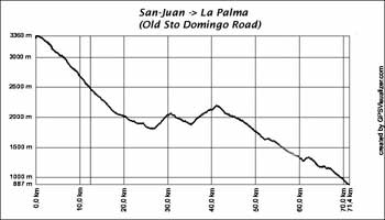
Elevation Profile
Soon, we reach an obscure, little traveled fork in the road (unsigned, of course, in the Ecuadorian style). One fork seems to go up, the other down. The driver consults with a group of campesinos on the roadside. "The road to Chiriboga" he says, and points to the downhill fork. I am skeptical, but down is good, I say to myself. And like so many times in the past, biking in Ecuador, I just decide to go with the best information I have and hope for the best. (As I have said before, this style of biking has its challenges.)
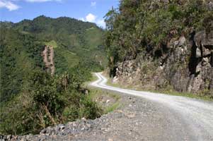
The Old Santo Domingo Road
The driver turns his cab around, gets out and pees (an Ecuadorian custom), and heads back to Quito. I am left alone, in a place where I have never been, about to head out on a road whose destination is questionable. If I had to backtrack I would have no idea of how to return to Quito, itself only a vaguely-defined sprawl where you could ride the streets and barrios for days without finding any real "center."
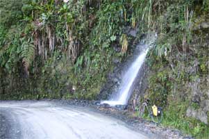
The Old Santo Domingo Road: Bike and waterfall
I put the front wheel in the fork, zero out the GPS, and head down. My direction is generally southwest, which is encouraging. It's 10 in the morning, so at least I've got plenty of daylight ahead. For a while I catch glimpses of the southern barrios of Quito over my left shoulder but soon the descent gets serious and all my attention is focused on the road ahead. It is dirt and gravel and follows the Rio ... until it bottoms out at Chiriboga, where I was approached by a well-dressed gentleman who appeared to be the town "greeter."
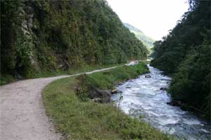
The Old Santo Domingo Road
After the usual questions: "Where do you come from? Where are you going? What country are you from?" he directed me to a store where I could buy water. Then "the mayor" (who, I had decided for some reason, he was) said "Que le vaya bien" (have a good trip) and I head out. From San Juan to Chiriboga the road had been eastward and downhill, following the river and general gradient of the western cordillera. It is not uncommon in the Andes for a village to be a punctuation mark for the topography.
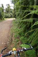
The Old Santo Domingo Road: Bike, ferns.
In other words, settlements tend to be at the bottoms or tops of things (where the road gets flat for a while).
Chriboga is no exception. From there, the road turned southward and upward, crossing watersheds, instead of "going with the flow" as before. For the biker, this translates into steep uphills and downhills. The "cross-watershed" itinerary is like this: (1) follow river for a while, (2) swing away from river, (3) climb, (4) reach summit, take a break, (5) descend to next river. (6) Repeat.
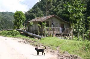
The Old Santo Domingo Road: Dog, oil pipeline, house.
[The rivers themselves are wild and beautiful, but if you are offended by oil pipelines (which, as a cyclist, you should be), be aware that oil is one of Ecuador's major exports. It is pumped from the Amazon to the coast. The elevated pipeline, unfortunately, runs along parts of this route, sometimes interfering with your view of the river. As if I needed any more reasons to hate oil.]
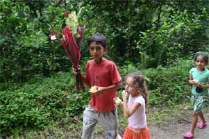
The Old Santo Domingo Road: Flowers for Mothers Day.
The final watershed is the Rio Toachi. The road descends below the 1000m level, where the transition zone between the sierra and the coastal zone begins, as signalled by the appearance of large tropical ferns and warmer, more humid air in your face. Across the river the old road joins the new, where I caught a bus back to Quito, following the same river upstream as far as Aloag.
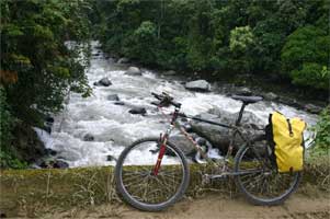
The Old Santo Domingo Road: Bike, Rio Toachi.