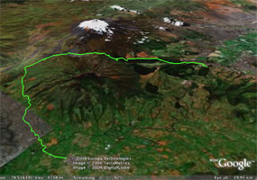
| Total Distance: | 47 km (29 mi) 40% ascent 60% descent |
| Total time: | 6 hours |
| Skill level: | Intermediate |
| Highest elevation: | 3885m (12,700 ft) |
| Lowest elevation: | 2870m (9,400 ft) |
| Surface: |
75% dirt/gravel (2-track) 20% stone 5% asphalt |
;)
Cotopaxi National Park
This is an amazing trip across the paramo, through the Cotopaxi National Park. It can be done in either direction. If we start at the south entrance to the park, we ascend from 3200m to 3800m, traverse the treeless plain, and culminate in a steep decent to the town of Machachi at the northern entrance to the park. It can be done in one long day, or 2 short ones, in which case we have dinner and spend the night at Tambopaxi Lodge, in full view of the mountain. We will also visit the Cotopaxi Natural History Museum and Limpiopungo Lake on the way up. Watch out for the Chagras (Andean cowboys) and the llamas!
Starting from the north entrance to the park involves a steep 900m climb. We then bike 15 km across the paramo at 3700m, descend to the southern entrance at 3200m, then bike th Pan-American highway 10km to Lasso, where we have dinner and spend the night at the elegant, 500-year-old Hacienda La Cienega.
Click to download .kml file for this route.
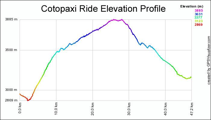
The Elevation Profile